

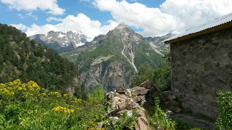
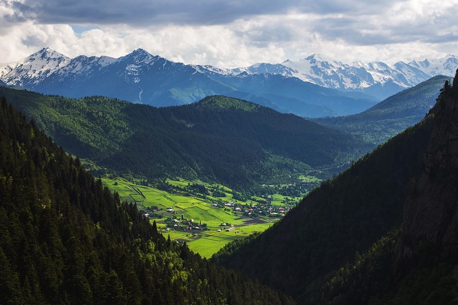
Mulakhi community
30 minutes (15km) away from Mestia by car and by trekking you can reach it in a few hours as its first villages of Mestia-Ushguli route. These historical villages populated by nice people look beautiful from Ughviri pass with summit Ushba in the background. Apart from Mestia-Ushguli route there are several interesting routes done from here.

Tetnuldi resort with summit in the background (Giorgi Nikolava)
Main Jeep Route In The Area, Tetnuldi Resort
I would say its more like ski resort and better to be visited in winter. But In summer by jeep you can get till 3000m and enjoy panorama. I would recommend views to Tetnuldi summit more than the views to Svaneti area below. If you are not trekking I suggest you do short hike to approach the summit and search for better views to it. Make sure your car’s engine doesnt get overheated as road goes very fast up and also, try to select early mornings or evenings for the ride when visibility is better.
@ Lamaria (Tamuna Asatiani)
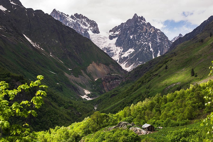
Mulakhi Lamaria Church Route
You can call it Zhabeshi virgin Mary Church of course, but Svan name for Virgin Mary Lamaria sounds well. This is totally 10km route but as you go up around 950m up elevation and down, its not so easy, you may need 5-6 hrs in total. Church is located on 2230m. Route starts from Zhabeshi village (GPS route I have from another village – Chvabiani), soon in 500m you come across River Tsanerula, fast and crazy mountain river which may be terrifying.
After crossing the bridge you go up north passing by lone tower which used to be a watch tower in the past, in 30 minutes you are already uphill and you can enjoy views of Mulakhi. The path goes at the edge of rocks where Alpine championships were held. Most of the route is chilling forested ascent and the more you go up, the better views you get and more glaciers you can observe. At the end of the route you enter beautiful field surrounded by trees. At the end of this field you will see small church (chapel) on the hill from where there is breathtaking view over Tetnuldi, Ushba, Lahili and Banguriani summits. You can see Tsaneri and Tviberi glaciers from here as well. The route can be an horseriding route if you know how to ride horse well.
The hut on the route
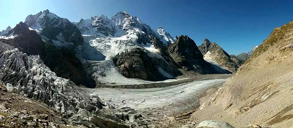
Tviberi route (Ilo Beria)
Tviberi Glacier Route
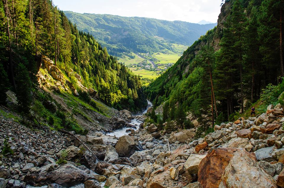
Tviberi is one of the glaciers of Mulakhi which is 9.5km long. The route itself is around 6-7 hr route (1-day hike). Route starts in Zhabeshi village on the left bank of craziest Tviberi river. On the route you visit many little waterfalls. There is little lake in the canyon which is camping site for longer route for amateur alpinists who want to explore the area. Its possible to get there in 1 day and come back for hikers. Hiking route closely follows river Tviberi and at some sections marked path may be damaged by the river and you may need to find a way via huge stones. Its recommended to take ropes and to have a guide for this route (check current condition with local guide).
You may have a chance to try some berries on the way. At some point you have beautiful view to Zhabeshi village and Mulakhi area. Passing through stony bank of river, you come across 2 waterfalls, one of those is called as tears of tired woman. Then you come across the hut where you can stop by. Soon you will reach the point from where we can see Kvitoldi glacier, summit Tikhtingeni (4618), Simi (or Semi pass) which is connected to Tsaneri river valley. At around 2310m Hiking route finishes, The lake is also nearby and it should be reachable.

Tviberi canyons, by Veronika Sorokina
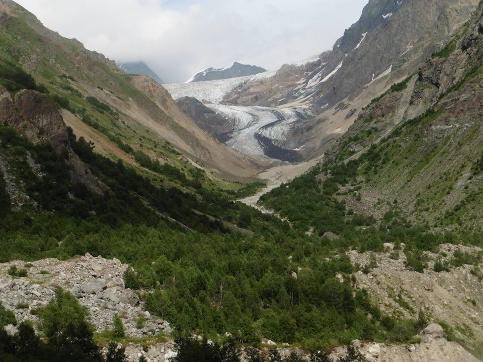
View to Kvitlodi glacier by Veronika Sorokina
Alpinist Route
if you are interested in one, Alpinist route in Svaneti could be an amazing experience as you manage to explore several glaciers, cross number of passes, climb up and down mountains, walk on glaciers, and connect Both Tviberi and Tsaneri glaciers this way. Alpinist route (description of the route was provided by my local alpinist guide) continues next day after camping at the lake, by crossing glacier/river. Route heads west 1km towards confluence of 2 rivers.
Then you continue towards Kvitlodi glacier (3km southwest) and you reach camping spot till you reach the glacier. 3rd day all day you walk on glacier and camp also on it also (between Kvitlodi and Simi glaciers). 4th day you again walk on glacier below Summit Tikhtingeni’s massif and then ascend to Simi pass (3700m) where you camp below Tikhtingeni summit. 5th day you can move to Tsaneri glacier and walk slowly climbing down some rocks. Then you will need to walk 5km on glacier and camp there. 6th day you go down in the forested area and descend in the village Zhabeshi. You need camping gear, ropes, crampons,axes, climbing harness for the route.
From Alpinist route, photo by Dan Novak
Facebook Comments